


Until 1838, when Iowa became its own U.S. Territory, the Hawkeye State was always part of another land. When it belonged to our Native American friends, our 35.7 million acres were divided up by tribes. When the French came exploring in 1673 and 1682, claiming this new land for King Louis XIV – Iowa became part of Louisiana (New France). In 1769 to 1801, the French gave most of Louisiana over to Spain (New Spain) – with Napoleon recovering it for France (1801-1803) before selling the whole package to the United States for $15 million in 1803.

- April 30, 1803 – Thomas Jefferson purchases Napoleon’s Louisiana.
- July 4, 1803 – The Louisiana Purchase is announced in the United States.
- March 10, 1804 – Upper Louisiana/District of Louisiana, administered by Indiana Territory, governed from St. Louis.
- March 3, 1805 – Part of the Territory of Louisiana, with the capital in St. Louis.
- June 4, 1812 – Louisiana attains statehood, part of the new Territory of Missouri, with the capital still in St. Louis.
- August 10, 1821 – Missouri attains statehood, so Iowa is left without official jurisdiction – “Unorganized” – until 1834.
- June 1, 1833. The Black Hawk Purchase of 1832 is opened to white settlers. The United States “purchased” six million acres of prime Iowa farmland from the Sac & Fox tribes for about 11 cents per acre.
- June 28, 1834 – Part of the Territory of Michigan, with the capital in Detroit.
- July 4, 1836 – Part of the Territory of Wisconsin, known as the District of Iowa with two counties: Dubuque and Des Moines. The capital was first located in Belmont, Wisconsin, but moved on a temporary basis to Burlington, Iowa in 1837, while a new capitol building was being built in Madison City, Wisconsin.
- July 4, 1838 – Becomes the Territory of Iowa, which Included all of present-day Iowa, Minnesota, and parts of the Dakotas. The capital remained at Burlington, Iowa, but relocated to Iowa City in 1841.
- April 5, 1844 – Iowans call for a Territorial Constitutional Convention to begin statehood process. A Territorial Census is taken in preparation for statehood, but statehood is voted down by Iowans due to boundary issues with Congress.
- December 28, 1846 – Boundary issues are resolved and Iowa attains U.S. statehood with the capital at Iowa City, which was moved to Des Moines in 1857.
This webpage will attempt to give you a look at some of the most important maps the good people of Iowa have used over the years to explore our beautiful land. Let’s start with our Native American brothers and sisters – who were residents here long before any Europeans came to disrupt their way of life…


Here are two early maps of Iowa – circa 1700’s – identifying the numerous Native American tribes who have lived here over the centuries. The map on the right indicates Pawnee (Panis/Panibousa), Ioway (Aiaouez/Aioureoua and Paoute/Paoutaoua), Dakota (Sioux), and Omaha (Maha). On the Illinois side of the Great River lived the Sauk and Fox (Meskwaki/Mesquakie) tribes. Click here to read more about these true Native Iowans.


In 1673, Father Jacques Marquette and Louis Jolliet became the first white men to explore the northern waters of the Great River – the Mississippi – which means Father of Waters. In 1682, Rene Robert Cavelier and Sieur de La Salle retraced much of Marquette & Jolliet’s footsteps, claiming all this land of the Mississippi River valley, including Iowa, for the King of France. In the early 1700’s, the French attempted to draw up maps of this expansive region called Louisiana. Click here to read more about Marquette & Jolliet’s 1673 Expedition.


On April 30, 1803, President Thomas Jefferson made the purchase of a lifetime. For $15 million dollars – the United States now “owned” the Louisiana Purchase. Iowa, of course, belonged to this massive land deal. Click here to read more about the Louisiana Purchase.


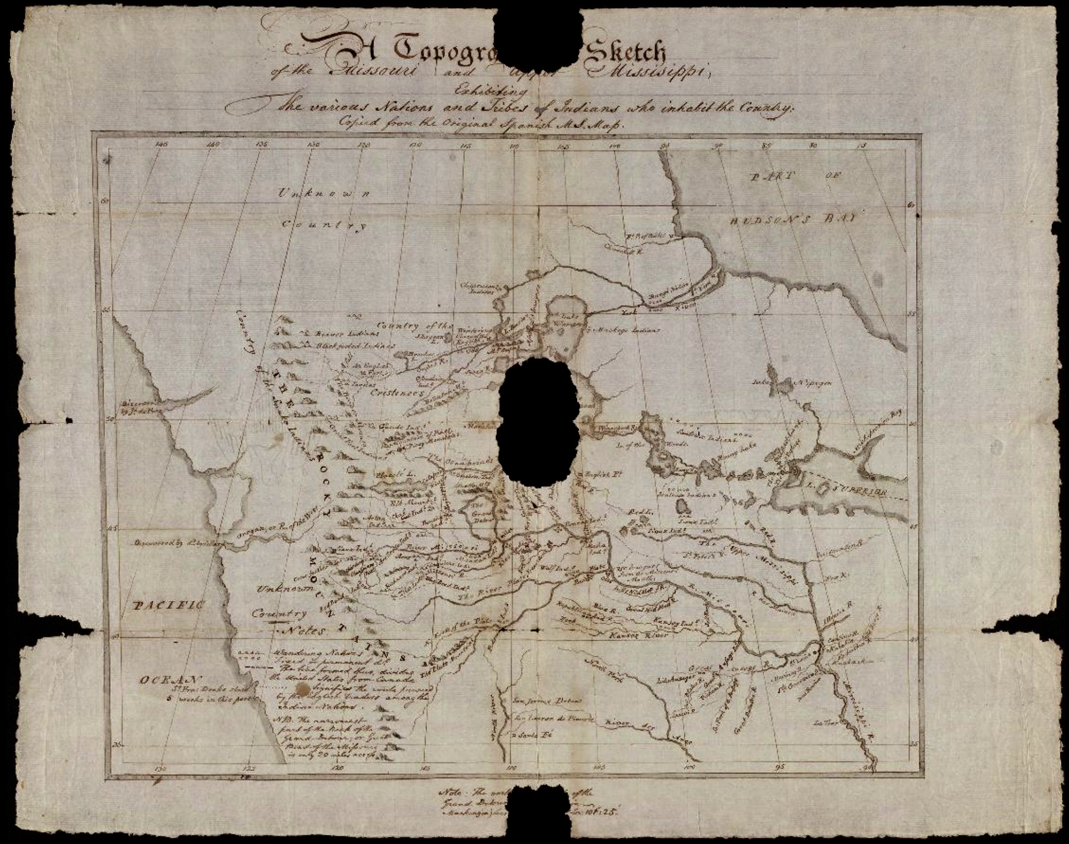
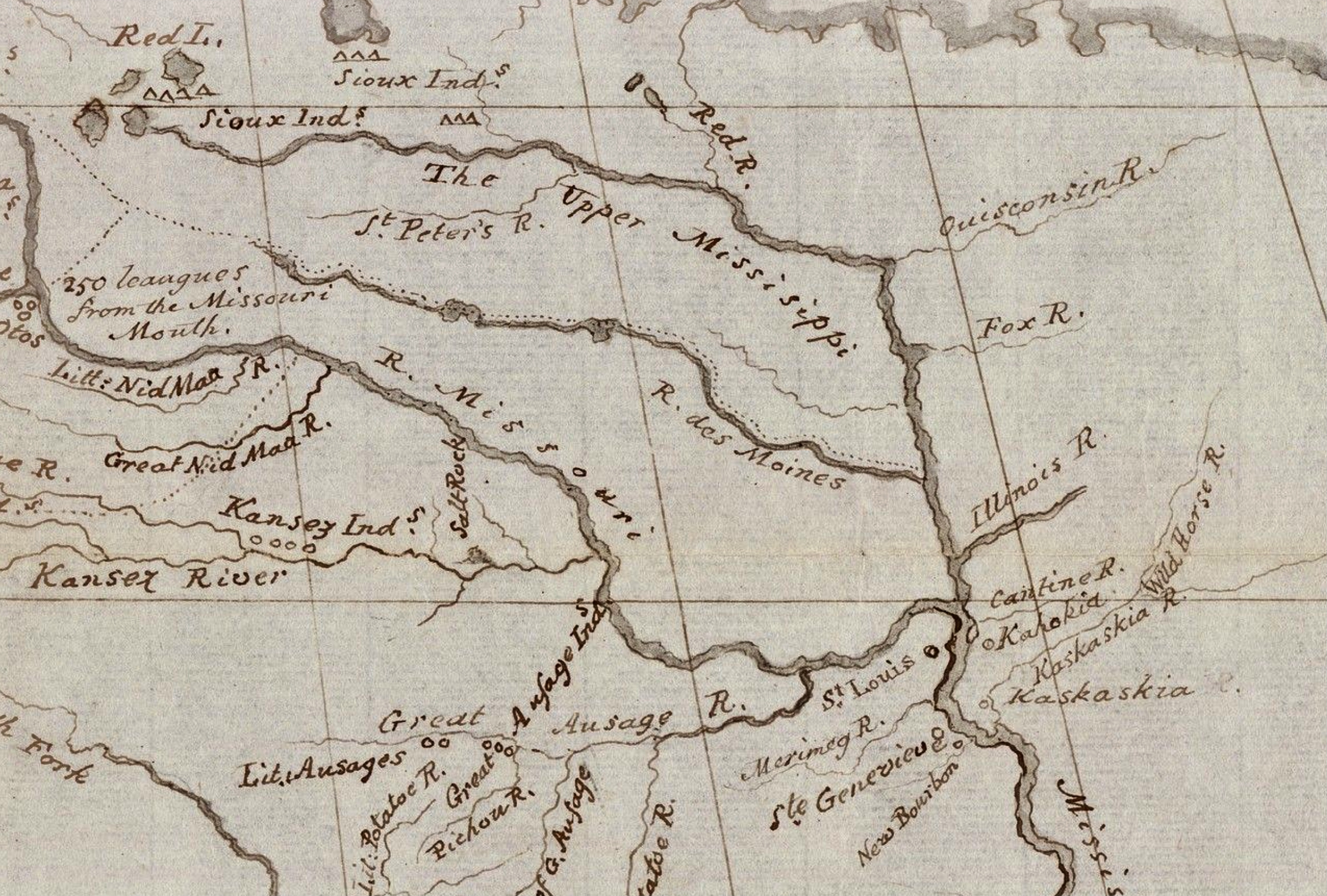
Here is Meriwether Lewis’ revised version of Soulard’s map, created at the end of their journey in 1806.


Many know about the Lewis & Clark Expedition – from St. Louis to the Pacific Ocean – but less know about Zebulon Pike and his similar assignment to explore the northern section of the Louisiana Purchase – traveling up the Mississippi River – looking for its headwaters. One of the most valuable long-term assets of Pike’s 1805-1806 expedition was the mapping of the Great River’s many tributaries. This information was invaluable for those who settled in Iowa over the next thirty years. Click here to read about Zebulon Pike and his 1805-1806 Expedition up the Mississippi River.


While Julien Dubuque came to Catfish Creek in 1788, all the other major Iowa, Wisconsin and Illinois cities located today on the Mississippi River were first settled based on these maps drawn up by Pike and his team. Click here to read about Julien Dubuque and his 1788 settlement on the Great River.


On March 9 and 10, 1804, two ceremonies, commemorated as Three Flags Day, were conducted in St. Louis, 1) to transfer ownership of Upper Louisiana from Spain to France, and 2) transfer the entire region from France to the United States. From March 10 to September 30, 1804, Upper Louisiana – of which Iowa was part of – was supervised as a military district, under its first civil commandant, Amos Stoddard, who was appointed by the War Department. On March 26, 1804, the Eighth Congress of the United States passed legislation entitled “An act erecting Louisiana into two territories, and providing for the temporary government thereof,” which “officially” established the Territory of Orleans – present day Louisiana – and the District of Louisiana – everything north of the 33rd parallel – as organized incorporated U.S. territories. On March 3, 1805, Congress passed legislation changing the District of Louisiana into the Louisiana Territory – effective July 4, 1805, with St. Louis as its capital. When Louisiana became a state – June 4, 1812 – the name was once again changed – this time to the Missouri Territory.


For thirteen years – 1821-1834 – Iowa was seen as “unorganized” territory by the U.S. government, but that certainly didn’t mean there wasn’t much activity in the region!

It was during this time, when fur-traders and other brave entrepreneurs made their way into Iowa, developing working relationships with the Sauk and Fox tribes, first along the Mississippi and then, pushing westward on the Great River’s tributaries: the Des Moines, the Skunk, the Iowa, and the Cedar Rivers. Read more here.


Between 1832 and 1851 all Native American lands had been “traded” away. But fortunately, that’s not the end of the story! In 1857, a small number of determined Native Iowans from the Sauk & Fox tribes returned to buy back about 6,000 acres, establishing, what is today known as, the Meskwaki Nation in Tama County in East Central Iowa. To our Native Iowan brothers and sisters, thank you for the kiowa (this is the place) heritage we share with you today! We are all richer because you have come back home! Click here to read the full story.


Above is a map of Iowa in 1833 – just prior to the Black Hawk Purchase opening to white settlers.


While Iowa was still “unorganized” territory, the Black Hawk Purchase – following the 1832 Black Hawk War – opened on June 1, 1833, giving new settlers legal access to six million acres of rich new land on the west side of the Mississippi. As a result, many new Iowa communities began to blossom, especially along the banks of the Mississippi.


In 1837, Na’je Nine and Ñiyu Mañi of the Ioway Tribe presented a detailed map (see above left) to the American officials, asserting claims over traditional lands in Iowa. As you can see, the Ioway map showcases an incredible knowledge of Iowa’s lands and rivers and the surrounding area. As Na’je Nine presented the map, he implored the Americans: “This is the route of my forefathers. It is the lands that we have always claimed from old times. We have the history. We have always owned this land. It is what bears our name.” Despite his strong argument, the government officials disregarded the detailed claims of the Ioway, instead, in 1838, choosing to set different boundaries, which, sadly, led to increased tensions between the Indigenous peoples while also pushing all of the tribes further west. Read more here.


On June 23, 1834, the U.S. House of Representatives introduced a bill that would include the “unorganized” lands of Iowa, Minnesota & the Dakotas into Michigan Territory. That bill passed, so on June 28, 1834, Iowa became part of Michigan Territory (Michigan and Wisconsin), with Detroit as the capital – see map below.


On September 6, 1834, the strip of land called The Black Hawk Purchase was divided into two counties – Dubuque and Des Moines. Both of these counties had one township each—Julien Township in Dubuque County and Flint Hill Township in Des Moines County. It is believed that these two townships were the very first local government divisions west of the Mississippi River.


It was during this time – 1835 – when a 27-year old Tennessee lieutenant named Albert M. Lea traveled up and down the Des Moines River valley with a Regiment of U.S. Dragoons. Their assignment was to map out this uncharted prairie the Sauk and Fox tribes called kiowa. The expedition was a success, but it wasn’t until Lea published his notes in book form (1836), calling this land The Iowa District, when Americans united around the name “Iowa” when describing this beautiful land west of the Mississippi River.

In the back of his 1836 publication – Notes on the Wisconsin Territory Particularly with Reference to The Iowa District or Black Hawk Purchase – Lieutenant Albert M. Lea included a large fold-out map of The Iowa District. This map is invaluable in giving us a look at Iowa as it was unfolding in 1835, two years after the Black Hawk Purchase was opened up to white settlers. For more info about Lea’s 1835 exploration, click here.


On July 4, 1836 – in preparation of Michigan becoming a state (1837) – the massive territory west of the Wolverine State was renamed Wisconsin Territory, with Belmont, Wisconsin being named as the capital. In 1837, as a new capitol building was under construction in Madison City, the territorial capital was temporarily moved to the growing river community of Burlington, Iowa. Read more here.


These two maps (above) come from the collection of the State Historical Society of Iowa
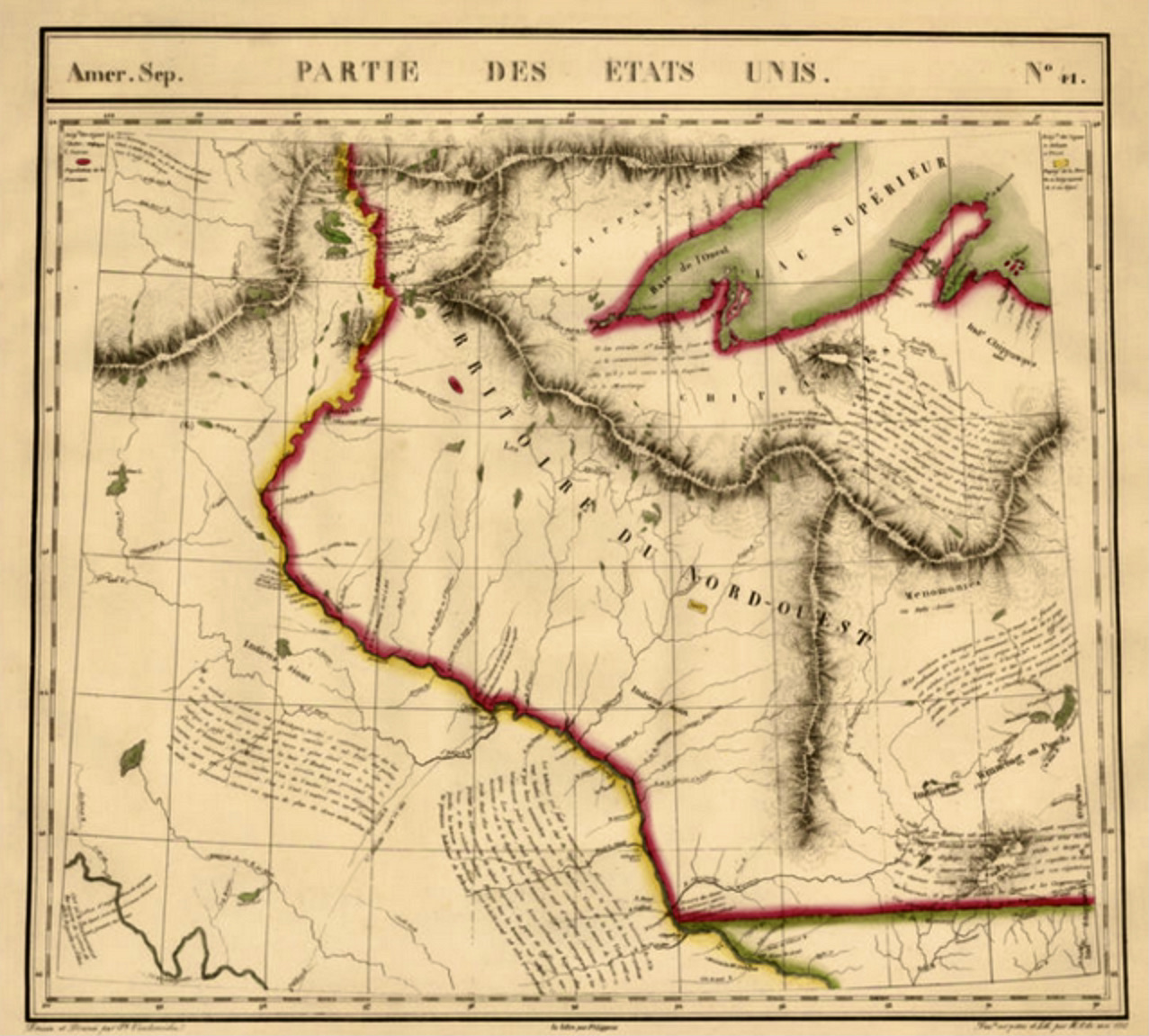
The Wisconsin Territory was divided into two districts: Wisconsin was one, with the other being called, as Albert Lea wrote about it in his book, The Iowa District – a region which also included Minnesota and parts of the Dakotas, covering about 194,000 square miles of land. The population of The Iowa District was 10,564.


On July 4, 1838, the growing Iowa District of the Wisconsin Territory was finally recognized as a separate territory, giving Iowans a whole new status of citizenship with their own territorial legislature. President Martin Van Buren appointed the former Ohio governor, Robert Lucas to oversee the new territory as its first governor. Lucas arrived by steamboat in Burlington in August of 1838, with one of his first moves being a relocation of the capital to a more centrally-located setting that would better reflect the growing population base of the territory. Click here to see more Territorial Maps of Iowa – including Johnson County – from 1838.


The map above comes from Map of the United States To Illustrate Jesse Olney’s School of Geography (1838).

1839 Map of Iowa Territory from John Plumbe’s book, “Sketches of Iowa and Wisconsin.” One of the earliest works published west of the Mississippi advocating immigration, Plumbe’s book provides us with an early overview of Iowa Territory. In the back of his book, Plumbe included a large fold-out map (see above). Click here to read more about John Plumbe, Jr.


The Proposed Map of Iowa by Samuel Augustus Mitchell (above right) – with 1844/1845 proposal.
In 1844, Iowans finally agreed to pursue statehood, writing a proposed state constitution and presenting it to the U.S. Congress. The application was accepted but only on the condition of boundary lines that would have made the map of Iowa (see above) quite different than it is today. Read more about this failed attempt at statehood here.


After a dismal failure to achieve statehood in 1844, the people of Iowa Territory requested from the Territorial Governor, James Clarke, that an updated proposed constitution for statehood be written. A second Iowa Territorial convention gathered in Iowa City in May 1846 and approved this State Constitution on May 18, 1846. Governor Clarke signed it on Sept 9, 1846 and it was then read to the U.S. House by Augustus C. Dodge on Dec 15, 1946, with President James Polk signing it into law on December 28, 1846, making Iowa the 29th state of the Union. Click here for more information about Iowa Statehood.


(L-0074) Above is a map of Iowa, Illinois, and Missouri from 1853. Engraved by Stiles, Sherman & Smith – entered into US Congress by Daniel Burgess, 1853.


In August 2021, a very rare J.H. Colton map (New York City) of Iowa came up on Ebay. Published in 1854, this fold-out map (14′ x 17″) was contained in a nice leather binding. An expensive map in its day, it went for $360 – which probably is a low price considering its great value. Beautiful!


(P-0395) Here’s a 1915 penny postcard featuring a map of the state of Iowa – obviously, the owner mapped out their trip across the state from north to south!


(L-0108) Here is an official 1946 Statewide Centennial Iowa Road Map – celebrating Iowa’s 100th Anniversary of its admission to statehood. Read more here.


We certainly hope you’ve enjoyed this graphic tour of the State of Iowa via maps made over the last 300+ years. In closing, here’s an intriguing pic (below) of Iowa’s current ninety-nine counties overlaid on Guillaume (William) de L’Isle’s 1718 map. Though the Missouri River is off by a few dozen miles (see southwest corner) and the counties are scrunched together just a bit east to west, I’d say not too bad for a map drawn from scratch over 300 years ago!


DYK-December 20, 2021
DYK-December 27, 2021
DYK-March 3, 2023
DYK-March 22, 2023
DYK-July 28, 2023
DYK-December 31, 2023

June 4, 1812 – Louisiana attains statehood, Iowa becomes part of the new Territory of Missouri, with the capital in St. Louis. A Day-by-Day Calendar of Historical Events In Iowa, William J. Petersen, State Historical Society of Iowa, 1946, p 53
June 1, 1833 – Six million acres – called the Black Hawk Purchase of 1832 – is open to new settlers. A Day-by-Day Calendar of Historical Events In Iowa, William J. Petersen, State Historical Society of Iowa, 1946, p 52
June 23, 1834 – The U.S. House of Representatives introduces a bill that would include the “unorganized” lands of Iowa, Minnesota & the Dakotas into Michigan Territory. A Day-by-Day Calendar of Historical Events In Iowa, William J. Petersen, State Historical Society of Iowa, 1946, p 59
June 28, 1834 – Iowa becomes part of Michigan Territory (Michigan and Wisconsin), with Detroit as the capital. A Day-by-Day Calendar of Historical Events In Iowa, William J. Petersen, State Historical Society of Iowa, 1946, p 60
September 6, 1834 – The Black Hawk Purchase is divided into two counties – Dubuque and Des Moines. Both of these counties had one township each—Julien Township in Dubuque County and Flint Hill Township in Des Moines County. A Day-by-Day Calendar of Historical Events In Iowa, William J. Petersen, State Historical Society of Iowa, 1946, p 87
Kudos to the amazing resources below for the many quotes, photographs, etc. used on this page.
Source for multiple Iowa maps – Old Maps Online
Looking Backward on Hawkeyeland, William J. Peterson, The Morrell Magazine, Dec. 1946
1718 – Delisle publishes map of Louisiana, savagesandscoundrels.org
Soulard’s Map of 1795, Meriwether Lewis, Yale University Library
Governing the Frontier, Alice Hoyt Veen, Prairie Roots Research, December 15, 2016
Louisiana Territory, Wikipedia
Wisconsin Territory, Wikipedia
State Shapes – Iowa Caucus Edition, Library of Congress
Misc. Maps of Iowa, John L’s Old Maps
Chouteau v. Molony, Encyclopedia-Dubuque
Joseph Nicollet and His Map, The Annals of Iowa, Volume 45 – Number 8 – Spring 1981, p 667
George Catlin 1835 map, Iowa History 101 – Iowa Dept of Cultural Affairs
Iowa History Daily: October 7 – An Ioway Map of Iowa, Kevin Mason, Notes On Iowa, October 7, 2023
Iowa and Wisconsin Territory 1844 Map, Morse & Breese, hearthstonelegacy.com
Iowa Territory 1844 Map, H.S. Tanner, hearthstonelegacy.com
Boundaries of Iowa proposed by the Iowa Constitutional Convention of 1844, Minopedia
U.S. Congress’ Proposed Map of Iowa – 1844, Benjamin F. Gue, WikiSource
Illustration of Iowa Territory 1838, J. Briggs, Palimpsest, Volume 44 Number 6, June 1963
A new map of Iowa: accompanied with notes by W. Barrows, 1845, Library of Congress
1851 Iowa Township Map, Henn, Williams & Co, Iowa DOT
Township Map Of The State Of Iowa, Henn, Williams & Co, David Ramsey Map Collection, 1851
Parker’s sectional & geological map of Iowa, 1856, Library of Congress
Railroads of Iowa, 1881, Library of Congress
Mildred Pelzer 1934 map, Iowa History 101 – Iowa Dept of Cultural Affairs
Click here to go on to the next section…
Click here for a complete INDEX of Our Iowa Heritage stories…