


(L-0111) (L-0124) Maps help us navigate our way through life. On this page, enjoy some of the many maps the good citizens of Johnson County have used over the last 200 years to navigate around our community nestled in the Iowa River valley.


The one map that might best display what “Iowa City” might have looked like in 1832 might be this one above. Archaeological evidence now indicates that this Native Iowan trail – we now call Sand Road – was the first “road” in Johnson County. That trail – worn into existence by the footsteps of numerous Meskwaki people – ran alongside the larger “road” used by our Native American friends – now called the Iowa River. Click here for more about the archaeological history of Johnson County


Iowa District in 1833 – just prior to the Black Hawk Purchase opening to white settlers. This 1833 map (above) traces the Des Moines River and, if you look closely, you also see to the north, the Iowa River. When fur traders began canoeing the many tributaries of the Mighty Mississippi, the Des Moines received the most attention. But in 1832, most historians believe that Sumner “Hawkeye” Phelps – who had been trading with the Sauk and Fox tribes along the Mississippi since the late 1820’s – followed the tribes as they were forced westward by the Black Hawk Purchase of 1832. Three Meskwaki (Fox) tribes moved onto familiar land they had used as summer hunting camps located on the Iowa River, just west of the Black Hawk Purchase boundary line – in and near the Keokuk Reserve – a 400-square-mile strip of land running along the Iowa River that was given to the Sauk chief for not participating in the 1832 Black Hawk War.


In 1835, Albert Lea mapped out a good portion of east-central Iowa, and when he published his map of “Iowa Territory” he showed an interesting view of what would later become Johnson County. Upon closer look (below) we find that Lea mapped out alongside the Iowa River:
1) Trding H. – we know this was the “first” American Fur Company trading post (house) on the Iowa River, built there by Sumner “Hawkeye” Phelps (circa 1832), and…
2) Poisheik’s V. – indicates the presence of Chief Powesheik and his tribal village built near the Iowa River (circa 1832) after being displaced from their villages on the Mississippi River by the Black Hawk Treaty.


Johnson County was established on December 21, 1837 by the legislature of the Wisconsin Territory – meeting in Burlington – one of thirteen new counties established by that body in a comprehensive act. Prior to this, the Black Hawk Purchase was composed of two large counties: Dubuque in the north, Des Moines in the south.
By 1837, John Gilbert and other white settlers had established a small vibrant community along the Iowa River, calling it Napoleon. So, with the help of some little white lies about population, Gilbert convinced the Wisconsin Territorial Legislature, meeting in Burlington, that Napoleon and Johnson County should be awarded a post office – the sign of “political favor” for any fledgling community located on the edge of civilization.


Below are two published maps of Iowa Territory from 1838 when Iowa was still a part of Wisconsin Territory. As you can see, Johnson County is located near the center (north/south) of the Black Hawk Purchase.


Click here for a complete timeline on Iowa’s “territorial” history (1803-1838).


July 4, 1838 – Iowa Becomes a U.S. Territory – On this Independence Day in 1838, Iowa was officially separated from Wisconsin Territory, decided by an Act of Congress that had been passed earlier that summer (June 12) in Washington D.C. The new governor of Iowa Territory, Robert Lucas, announced that Burlington would remain as the “temporary” capital of Iowa, only until such time when a more centrally-located capital city could be determined. On January 21, 1839, Lucas issued the following decree:
An Act to locate the Seat of Government of the Territory of Iowa … so soon as the place shall be selected, and the consent of the United States obtained, the commissioners shall proceed to lay out a town to be called “Iowa City.”
By early May 1839, three commissioners, Chauncey Swan, John Ronalds and Robert Ralston, were about the business of surveying Johnson County in search of the perfect location for Governor Lucas’ “Iowa City.” Read about that story here.


This rare book from 1839 provides us with the one of the earliest overviews of Iowa Territory. In the back of his book, Plumbe included a large fold-out map which indicates the new “City of Iowa” as it had now been established as the new Iowa Territorial capital city!


“That was Iowa City in July, 1839 — a map, a paper plat, recorded in the office of I. P. Hamilton, the recorder of Johnson County.” Benjamin Shambaugh
The first surveying of Iowa City, done in 1839, resulted in a series of maps, drawn up by Leander (L.) Judson. This map became the city’s blueprint for the first 20 years of existence and has served Iowa City historians well over the years, as it represents our fair community as it was…in the beginning.

Under U.S. law, when a new Territory was established in the west, that territorial government was allowed to choose a full section of land – one square mile or 640 acres – to establish its capital. As we’ve told you elsewhere, in May 1839 – Chauncey Swan and his companions staked out an uncharted piece of wilderness located on the Iowa River – legally called Section 10 – Township 79 North, Range 6 – West 5th Principal Meridian in Johnson County. By July 4, 1839, that piece of land – one square mile – had been surveyed and drawn out by Judson on the map you see below.


Here’s a comparison between the 1839 map of Iowa City and the 1854 map – with red lines indicating the original city layout. Read more.


Here’s a comparison between the 1839 map of Iowa City and the 1868 map – with red lines indicating the original city layout. Read more.


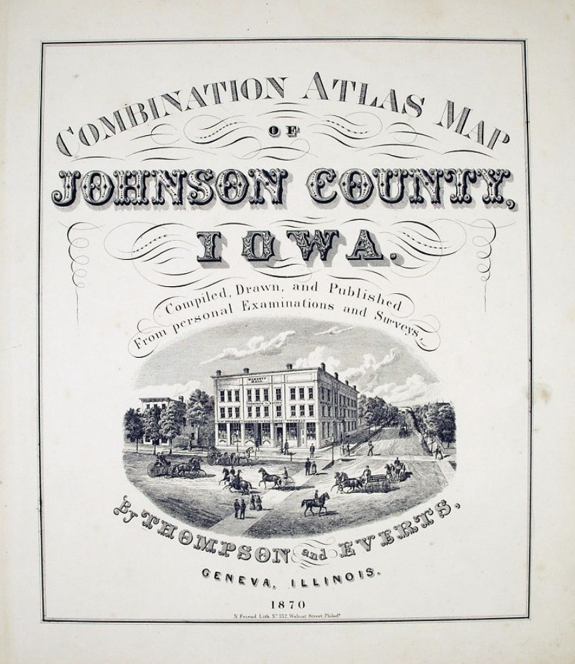
In 1870, the publishing company from Geneva, Illinois – Thompson & Everts – published a multiple-page atlas of Johnson County and Iowa City – featuring maps and 10 pages of etchings.


Here’s a comparison between the 1839 map of Iowa City and the 1875 map – with red lines indicating the original city layout. Read more.


Here’s a comparison between the 1839 map of Iowa City and the 1892 map – with red lines indicating the original city layout. Read more.


At the turn-of-the-century (1900), The Huebinger Survey and Map Publishing Company produced a massive Atlas of Johnson County and in it were several maps of Iowa City, East & West Lucas Townships, and other Johnson County locations.


Here’s a comparison between the 1839 map of Iowa City and the 1900 map – with red lines indicating the original city layout. Read more.


Here’s a comparison between the 1839 map of Iowa City and the 1920 map – with red lines indicating the original city layout. Read more.


Here’s a comparison between the 1839 map of Iowa City and the 1930 map – with red lines indicating the original city layout. Read more.


Here’s a comparison (above) between the 1839 map of Iowa City and the 2000 map – with red lines indicating the original city layout. Today (below) in 2023, the population of Iowa City is around 75,000 with Johnson County being the home to 155,000. As you can see, the “original” 1839 Iowa City (in red) has now been surrounded by our ever-expanded community. Read more.


DYK-February 6, 2023
DYK-February 13, 2023
DYK-February 15, 2023
DYK-March 13, 2023
DYK-March 15, 2023
DYK-May 7, 2023

Kudos to the amazing resources below for the many quotes, photographs, etc. used on this page.

Aerial Photo of Iowa City, Iowa, Greg Comer’s America From The Sky
Sand Road/Sand Lake/Glacial History, Terry Trueblood Recreation Area, Sarita Zaleha, Iowa City Parks
1839 Map of Iowa City by L. Judson, University of Iowa Digital Library
1854 Map of Iowa City & Environs by J.H. Millar, University of Iowa Digital Library
1854 Map of Iowa City & Environs by J.H. Millar, Boston Rare Maps
1868 Bird’s eye view of Iowa City, Johnson County, A. Rugar, Library of Congress
1870 Combination Atlas Map – Johnson County, Thompson & Everts, University of Iowa Digital Press
1870 Combination Atlas Map – Iowa City, Thompson & Everts, University of Iowa Digital Press
1870 Combination Atlas Map – Iowa City, Thompson & Everts, Historic Map Works
1875 Map of Johnson County, Iowa, A.T. Andreas, David Rumsey Map Collection
1875 Plan of Iowa City, Marengo, & LeClaire, A.T. Andreas, David Rumsey Map Collection
1900 map – Iowa City, Atlas of Johnson County, University of Iowa Digital Library
1900 map – Iowa City 1 – Huebinger Survey and Map Publishing Co., Historic Map Works
1900 map – Iowa City 2 – Huebinger Survey and Map Publishing Co., Historic Map Works
1900 map – Iowa City 3 – Huebinger Survey and Map Publishing Co., Historic Map Works
1900 map – Iowa City – Map of East & West Lucas Townships, City of Iowa City – Twitter.com
Iowa City – Atlas of Johnson County, Iowa, 1900, University of Iowa Digital Libraries
Johnson County – Atlas of Johnson County, Iowa, 1900, University of Iowa Digital Libraries
Atlas of Johnson County, Iowa, 1900 3 City maps, University of Iowa Digital Libraries
Photos from: Finials – A View of Downtown Iowa City, Marybeth Slonneger, pp 20-21
Source for multiple Sanborn Fire Insurance Maps – Library of Congress
Source for multiple Iowa City & Johnson County maps – Historic Map Works
Source for multiple Iowa City & Johnson County maps – Old Maps Online
Source for multiple Iowa City & SUI maps – University of Iowa Digital Library
Click here to go on to the next section…
Click here for a complete INDEX of Our Iowa Heritage stories…