

On returning from his 1805-1806 Mississippi River Expedition, Zebulon Pike described his men as being “perfectly capable of getting the job done, but all in all, a set of Dam’d Rascals!”


When most folks hear the name Zebulon Pike, their thoughts generally take them to the Rocky Mountains and one of the best-known mountain tops in Colorful Colorado: Pikes Peak – just west of Colorado Springs. But when you dig deeper into the story of Zebulon Pike, you’ll find that there’s another Pikes Peak – an earlier one – located right here in the Hawkeye State.


Zebulon Montgomery Pike was born on January 5, 1779, near Lamington, New Jersey, the son of Isabella (Brown) and Zebulon Pike. Zeb, as he was called, joined the U.S. Army, in his father’s regiment as a cadet in 1794, at the age of 15. He became a 2nd Lieutenant early in 1799 and a 1st Lieutenant later in 1799 (age 20), following in the footsteps of his father, who was a veteran of the American Revolution and was still an active duty officer when young Pike joined. Zeb married Clarissa Harlow Brown in 1801, and they had only one child who survived to adulthood, Clarissa Brown Pike, who later married President William Henry Harrison’s son, John. Sadly, Zebulon and Clarissa had four other children who died before reaching adulthood.

Lieutenant Pike’s early duties along the Ohio frontier consisted of supervising the transportation and distribution of supplies to the various frontier posts via the Ohio River. Assigned a logistics and payroll position at Fort Kaskaskia, Illinois on the Mississippi, he caught the attention of the Governor of the Upper Louisiana Territory in St. Louis and became his protégé.


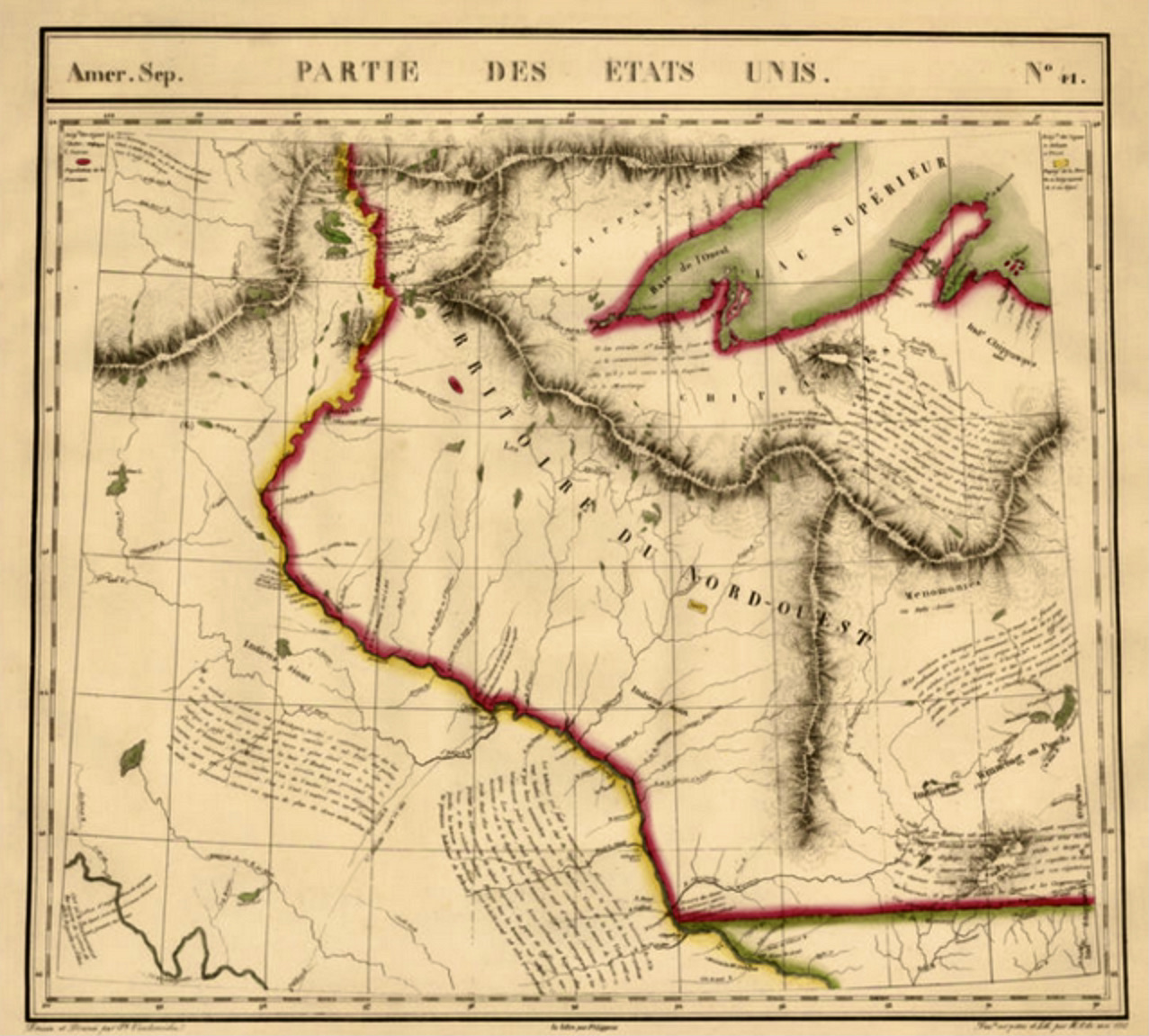
As we discussed earlier, in 1803, President Thomas Jefferson made a purchase that changed the American story. In one fell swoop, the United States added 530 million acres (828,000 sq miles) from the Mississippi River to the Rocky Mountains, between Canada and the Gulf of Mexico. As you can see from the map above, Iowa was a small part of that big expanse of land called the Louisiana Purchase.

By the summer of 1805, while Lewis and Clark were standing at the headwaters of the Missouri River, halfway through their expansive two-year expedition, Zebulon Pike was back in St. Louis, about to be given a similar assignment as Lewis and Clark. While this one will go north out of St. Louis up the Mississippi River, and not west on the Missouri, the task will still entail a good deal of bravery and courage.


One-hundred and thirty two years earlier (1673), Father Jacques Marquette and Louis Jolliet became the first white men to explore these the northern waters of the Great River, and in the early 1700’s, the French drew up a couple of maps of the region (see above). Now, the Americans “owned” this land, and it was Zebulon Pike’s job to explore the northern portion of the newly purchased Louisiana Territory (1803), mapping it out along the way. Here are just a few of the small assignments given to Zeb and his team of twenty men:
- Locate the headwaters of the mighty Mississippi River.
- Survey and purchase strategic pieces of land from Native Americans for future use as military posts.
- Invite and bring back to St. Louis a few important Native American chiefs for peace talks.
- Confront any British soldiers and/or Canadian fur-traders for violations of treaty and international protocol associated with the newly-acquired Louisiana Purchase.
- And, oh yes, have a safe and enjoyable trip!


Zeb and his team of Dam’d Rascals left St. Louis, Missouri on August 9, 1805, traveling on a seventy-foot keelboat up the Mississippi. They reached the confluence of the Mississippi and Minnesota Rivers on September 21, where Pike negotiated a treaty with the Dakota tribe, purchasing the future site of Fort Snelling. The expedition proceeded further upriver, stopping to construct a winter camp at the mouth of the Swan River, south of present-day Little Falls, on October 16. On December 10, they continued upstream along the frozen river on foot, visiting several British North West Company fur posts along the way.
The team reached the fur post at Leech Lake on February 1, 1806 and stayed nearly three weeks. Zeb informed the traders they were within the boundaries of the United States and henceforth required to abide by its laws and regulations, also meeting with many prominent Ojibwe chiefs, prevailing on them to surrender the medals and flags given as tokens of allegiance by the British and offering American peace medals in their place. Pike also relayed the United States’ desire that the Ojibwe and Dakota cease their mutual hostility and invited the chiefs to attend a peace conference in St. Louis, but all declined the invitation. On February 10, Zeb and his Dam’d Rascals ceremonially shot the British red ensign from the fur company’s flag pole, replacing it with an American flag.
On a short side trip – February 12 to 14 – Pike traveled to the North West Company fur post on Upper Red Cedar Lake (later renamed Cass Lake), designating it as the upper source of the Mississippi and taking celestial observations to determine its latitude. BTW: Zeb missed it here. Cass Lake is not the primary source for the Mississippi. It’s actually Lake Itasca, which is located about 40 miles west of Cass Lake. Close but no cigar.
On February 18, Pike and his men left Leech Lake, carrying diplomatic tokens from the Ojibwe chiefs to present to the Dakota chiefs as a gesture of reconciliation, arriving at their winter encampment on March 5. There, they re-embarked in their keelboat for the downriver journey on April 7, reaching St. Louis on April 30, 1806. Mission accomplished.


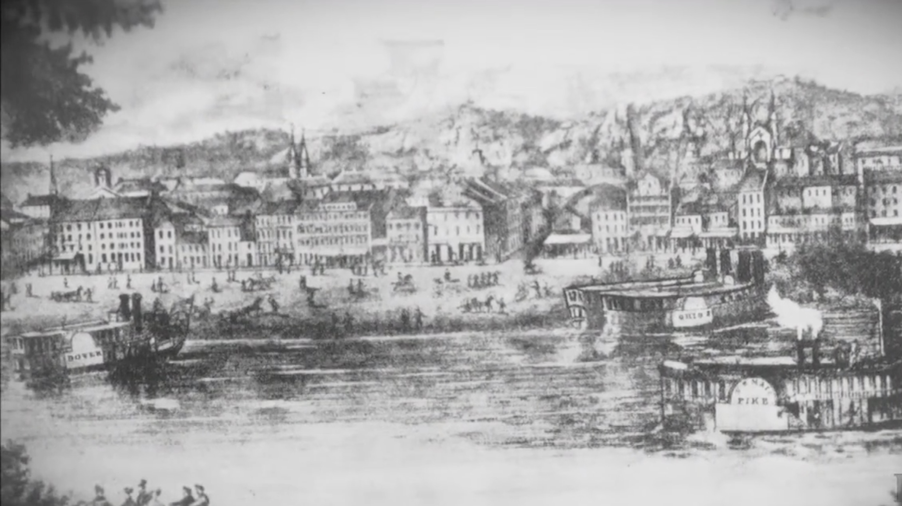
On the way up the Mississippi, Zeb and his team spent twenty-three days on the “Beautiful Land” that would eventually be called Iowa, camping eleven of those nights on the Hawkeye side of the Great River. On August 23, 1805 – Lieutenant Pike wrote in his diary, recommending the present site of Burlington as a “handsome situation” for a fort.
On the return trip, with the Father of Waters helping them along, they spent just eleven days in Iowa, with many of the encampments from their ascent being used once again on their way south toward St. Louis.


Records indicate that one of Pike’s first encounters with Native Americans was when he met – in late August – with the Sauk Chief Black Hawk and his tribe located in Saukenuk (today’s Rock Island in the Rock River Valley) on his way up the Mississippi. Saukenuk was started in the 1730’s, and by the early 1800’s had become one of the largest and most advanced Native American communities (over 6,000 souls) in North America. Below is Black Hawk’s memories of Pike’s visit. Read more here.


On his way north, Zebulon Pike met the French fur-trader, Julien Dubuque. It was September 1, 1805, and in his journal, Pike writes…
“(We were) saluted with a field piece (small cannon) and received every mark of attention.”
As he was assigned to do, Zeb was required to record information about the mines being worked by Dubuque at the time, but he found “the evasive Mr. Dubuque” to be polite but not very talkative. According to Pike, “it was impossible for me to make my report by actual inspection,” so he posed questions of Dubuque instead. In truth, Dubuque, who had worked out an agreement with the Spaniards to work the lead mines near Catfish Creek, did not know whether the Americans would allow him to keep the land which had been given to him. Click here to read more about Julien Dubuque and his Mines of Spain.
One good thing that came from Pike’s visit with Dubuque was an addition to the team – a Frenchman named Blondie who became a helpful translator for Pike on the remainder of his trip. Through Blondie’s help, Zeb learned that many of the Native Americans he met lived in great fear of the white man. One chief told him that “the women and children were frightened at the very name of an American boat.” Fortunately, Pike and his Dam’d Rascals were fair and honest white men who did their best to build peaceful relationships with these true Native Americans who had never expected to have their homes invaded by these strange new faces from across the sea.


One of the most valuable long-term assets of Pike’s 1805-1806 expedition was the mapping of the Great River’s many tributaries. This information (see charts below) was invaluable for those who first settled in Iowa over the next thirty years. While Julien Dubuque came to Catfish Creek in 1788, all the other major Iowa, Wisconsin and Illinois cities located today on the Mississippi River were first settled based on these maps drawn up by Pike and his team.


“Over 132 years later (after the Marquette and Joliet expedition- 1673) Zebulon Pike explored the area as a suitable site location for a military fort. He determined that with the high bluffs and expansive views it was a good location, however Fort Crawford was actually built down in the floodplain of the Mississippi River and had to move three times due to flooding. As the east expanded westward, the settlers came and communities were developed where the resource provided fertile lands to grow crops, animals for trapping and trade, and a river for transportation and business ventures, as it is still used today.”


As many know, Zebulon Pike went on to become the well-known explorer of the Rocky Mountains and the great South West. In 1810, Zeb published an account of his expeditions, a book so popular that it was translated into several languages for publication in Europe. He later achieved the rank of brigadier general in the American Army and served during the War of 1812, until he was killed during the Battle of York in April 1813, outside the British colonial capital of Upper Canada.
Donald Jackson in his forward to the 1966 annotated edition of Pike’s journals and letters noted …
“Nothing Zebulon Montgomery Pike ever tried to do was easy, and most of his luck was bad. But he made up for misfortune with strong tenacity.”
Thanks, Zeb and your band of twenty Dam’d Rascals, for the strong tenacity needed to chart out the course for so many future Iowans to come.

DYK-October 29, 2021

August 23, 1805 – Lieutenant Zebulon Pike recommends the present site of Burlington as a “handsome situation” for a fort. A Day-by-Day Calendar of Historical Events In Iowa, William J. Petersen, State Historical Society of Iowa, 1946, p 82
September 1, 1805 – On his way north, Lieutenant Zebulon Pike meets the French fur-trader, Julien Dubuque. A Day-by-Day Calendar of Historical Events In Iowa, William J. Petersen, State Historical Society of Iowa, 1946, p 85
February 1, 1806 – Zebulon M. Pike reaches Leech Lake and erroneously describes it as source of the Mississippi River. A Day-by-Day Calendar of Historical Events In Iowa, William J. Petersen, State Historical Society of Iowa, 1946, p 17
Kudos to the amazing resources below for the many quotes, photographs, etc. used on this page.
Pikes Peak State Park, Iowa, Iowa State Parks website
Life of Black Hawk – Ma-ka-tai-me-she-kia-kiak, Antoine LeClaire,1834, pp 37-38
Pike in Iowa (1st Expedition), Pike National Historic Trail Association
Click here to go on to the next section…
Click here for a complete INDEX of Our Iowa Heritage stories…